

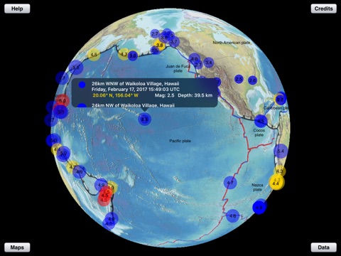
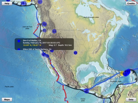

This app displays the most recent earthquakes on a 3D globe (or a 2D map) that can be enlarged. Select a time range and minimum magnitude in a data controls pop-up. Then tap an earthquake circle to see a list of all earthquakes at that location, sorted by date and time. For each earthquake in the list the date, time, latitude, longitude, magnitude, and depth are displayed.
Pop-up data controls allow you to select: the date range (up to the previous weeks earthquakes), the range of magnitudes and depths that are displayed, and a view of recent volcanic activity or historic, large earthquake locations.
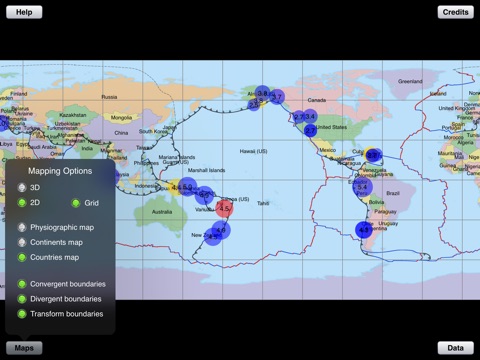
Pop-up map controls allow you to select the type of plate boundaries displayed as well as different maps that show physiographic features, continents, or countries. Use these controls to study the relationship between earthquakes, volcanoes and tectonic plate boundaries.
Earthquake data is obtained from a USGS data feed and is updated every 5 minutes (requires an internet connection).